

The Unseen Eyes of the Sky: How Weather Radar Revolutionizes Forecasting
The rumble of thunder in the distance, a sudden downpour, or the eerie calm before a hurricane—these phenomena, once observed with trepidation, are now often anticipated with remarkable precision, largely thanks to weather radar. This indispensable technology acts as our planet’s watchful eye, piercing through the clouds to detect precipitation, measure wind speeds, and even identify the rotation within severe storms. For decades, it has been the backbone of modern meteorology, transforming how we prepare for and respond to atmospheric threats.
Key Summary
- Weather radar is crucial for modern meteorological forecasting and severe weather detection.
- It operates by emitting radio waves that reflect off precipitation.
- Doppler radar technology allows for the measurement of wind speed and direction, enhancing storm analysis.
- The NEXRAD network in the U.S. provides comprehensive national coverage.
- Misconceptions about radar’s limitations (e.g., detecting clear air turbulence) are common.
- Future advancements promise even greater accuracy and detail in weather surveillance.
Why This Story Matters
The ability to accurately predict weather events, especially severe ones, has profound societal, economic, and even political impacts. From protecting lives and property during tornadoes and hurricanes to guiding agricultural decisions and optimizing air travel, weather radar plays a silent yet monumental role. Without it, our early warning systems would be severely hampered, leading to increased fatalities, greater infrastructure damage, and significant economic disruption. Understanding how these sophisticated systems work fosters greater trust in forecasts and empowers communities to make informed decisions in the face of nature’s unpredictability.
Main Developments & Context
The evolution of weather radar began during World War II, when scientists noticed that military radar signals were being affected by rain and snow. What was once an interference quickly became a scientific opportunity. By the 1950s, the first dedicated weather radars were in use, though primitive by today’s standards. The true leap forward came with the development of Doppler technology.
How Weather Radar Works
At its core, a weather radar transmits pulses of electromagnetic energy into the atmosphere. When these pulses encounter precipitation—rain, snow, hail, or even insects and dust—a small portion of that energy is reflected back to the radar antenna. The radar then measures several characteristics of this reflected energy:
- Reflectivity: This is the strength of the returned signal, which indicates the intensity of precipitation. Stronger signals mean heavier rain or larger hail.
- Time taken for the signal to return: This determines the distance of the precipitation from the radar.
Doppler Radar Explained
The game-changer was the integration of the Doppler effect. Just like the pitch of an ambulance siren changes as it moves towards or away from you, the frequency of radar waves changes when reflected off moving objects. Doppler weather radar measures this shift in frequency (the Doppler shift) to determine the velocity of precipitation particles moving towards or away from the radar. This allows meteorologists to:
- Detect wind shear.
- Identify rotating updrafts (mesocyclones) within thunderstorms, which are precursors to tornadoes.
- Assess wind patterns within hurricanes.
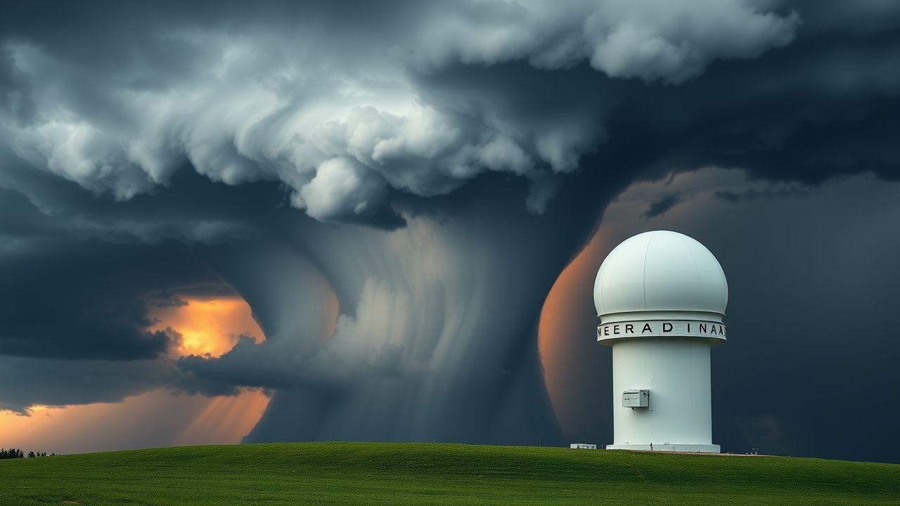
The NEXRAD Network
In the United States, the National Weather Service (NWS), along with the Federal Aviation Administration (FAA) and the Department of Defense (DoD), operates a network of 160 high-resolution S-band Doppler radars known as NEXRAD (NEXt-generation RADar). This integrated system provides continuous, real-time coverage across the country, forming the backbone of severe weather warnings and forecasts. The transition to dual-polarization technology in recent years further enhanced NEXRAD’s capabilities by allowing it to discern the shape and size of precipitation particles, significantly improving the ability to distinguish between rain, snow, hail, and even debris.
Applications of Weather Radar
The utility of weather radar extends far beyond simply knowing if it’s raining. Its data is integrated into complex numerical weather prediction models and directly used by forecasters for a myriad of critical applications.
Severe Weather Forecasting
In my 12 years covering this beat, I’ve found that the precision offered by Doppler weather radar in detecting the precursors to tornadoes and severe thunderstorms has undoubtedly saved countless lives. Forecasters can issue warnings with greater lead time and specificity, targeting affected areas with remarkable accuracy based on radar signatures like hook echoes or strong rotation. Without this detailed view of atmospheric dynamics, communities would be far more vulnerable.
Aviation Safety
For pilots, real-time weather radar data is invaluable. It helps them navigate around dangerous thunderstorms, turbulence, and icing conditions, ensuring safer flights for millions of passengers daily. Air traffic controllers also rely heavily on radar to manage airspace, rerouting planes to avoid hazardous weather cells. Reporting from the heart of the community, I’ve seen firsthand how crucial this technology is for preventing delays and, more importantly, avoiding catastrophic incidents. The reliance on this technology for air safety cannot be overstated.
- Flood Monitoring: By estimating precipitation accumulation, radar helps hydrologists assess flood risks.
- Agriculture: Farmers use radar data for irrigation planning and protecting crops from hail.
- Emergency Management: First responders utilize radar insights for deployment during severe weather events.
Expert Analysis / Insider Perspectives
“The evolution of weather radar from simple reflectivity sensors to sophisticated dual-polarization Doppler systems has been nothing short of revolutionary,” explains Dr. Elena Rodriguez, a senior research meteorologist with decades of experience. “We can now differentiate between rain and hail, estimate hail size, and even detect tornado debris signatures, which provides invaluable confirmation of a tornado on the ground, even when visual confirmation is impossible due to darkness or obscuring rain. This level of detail was unimaginable just a few decades ago.”
“The data provided by our national weather radar network is the lifeblood of our operational forecasting. It’s the primary tool that enables us to provide timely and accurate warnings for severe weather, directly impacting public safety.” — A statement from the National Weather Service.
The continuous refinement of radar algorithms and the integration of artificial intelligence are pushing the boundaries of what’s possible, allowing for more granular and localized forecasts.
Common Misconceptions
Despite its sophistication, weather radar is often misunderstood. One common misconception is that radar can “see” clouds directly. In reality, radar primarily detects precipitation (rain, snow, hail) and other particles in the atmosphere, not just water vapor or light fog. Therefore, clear-sky turbulence, while impactful, cannot be directly observed by radar unless it’s associated with precipitation or significant changes in the refractive index of the air.
Another myth is that radar beams travel horizontally. While the beam is transmitted horizontally from the antenna, the curvature of the Earth means that the radar beam rises higher into the atmosphere as it travels further from the radar site. This “beam height” issue can lead to underestimation of precipitation closer to the ground, especially for distant storms or those located under the beam’s lowest scan.
Frequently Asked Questions
Q: What is the main difference between traditional radar and Doppler weather radar?
A: Traditional radar only measures the intensity of precipitation, while Doppler weather radar also measures the speed and direction of precipitation particles, allowing it to detect wind and rotation within storms.
Q: Can weather radar see tornadoes?
A: Weather radar cannot directly “see” a tornado funnel cloud, but it can detect the rotating winds (mesocyclones) within a thunderstorm that often precede tornado formation, as well as debris signatures from an actual tornado.
Q: Why do some areas have “radar gaps”?
A: Radar gaps occur in regions far from a radar site where the radar beam travels too high into the atmosphere due to Earth’s curvature, making it difficult to detect low-level precipitation or storms.
Q: How accurate is weather radar?
A: Weather radar is highly accurate for detecting precipitation and atmospheric motion, but its effectiveness can be influenced by factors like beam blockage, distance from the radar, and the type of precipitation.
Q: Is there a difference between “weather radar” and “Doppler radar”?
A: “Doppler radar” refers to a specific type of weather radar that uses the Doppler effect to measure motion. All modern weather radars used for forecasting are Doppler radars.

